Typhoon Nanmadol to grow stronger, come closest to S. Korea within 2 days: KMA

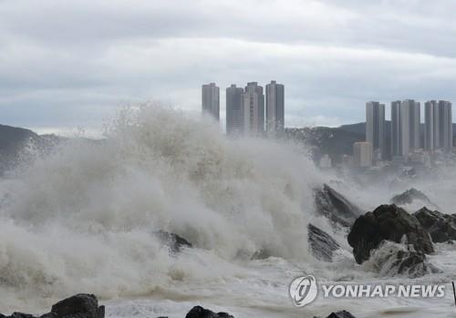
SEOUL, Sept. 17 (Yonhap) — Typhoon Nanmadol, currently passing the waters east of Japan’s Okinawa, is expected to grow stronger Saturday before coming closer to South Korea in the next couple of days, the state weather agency said.
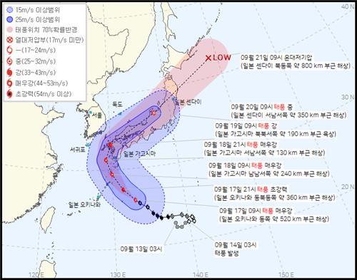
With a central atmospheric pressure of 920 hectopascals and a maximum wind speed of 53 meters per second, this year’s 14th typhoon was passing waters 520 kilometers east of Okinawa at 9 a.m., according to the Korea Meteorological Administration (KMA).
Nanmadol, currently a “very strong” typhoon, was forecast to develop into a “super strong” one later in the day.
Typhoons are classified into four categories: medium, strong, very strong and super strong. Super strong refers to typhoons with a maximum wind speed of at least 54 meters per second.
According to the KMA, Nanmadol is expected to land in Japan’s Kyushu Island on Sunday and come closest to South Korea the following day, between early morning and afternoon.
“A typhoon alert may be issued on Jeju Island and the southeastern coast between Sunday afternoon and Monday morning as the regions come under the influence of Nanmadol’s heavy winds,” the KMA said, warning the maximum wind speed could reach up to 35 meters per second in those areas.
Heavy rain will fall on Jeju and the Gyeongsang provinces in the next two days, with precipitation of up to 150 millimeters forecast in the southeastern coastal region, the KMA added.


